Skip to main content
Search
Navigazione principale
About
Products
Data access
Collaborate
News and events
Resources
Training
Notifications
EFAS Wiki
News
News
2022-03-07
Job Opportunity - Production Analyst
News
2022-02-23
Important information for Climate Data Store users
News
2022-02-14
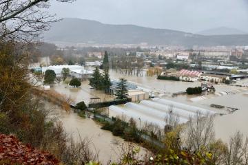
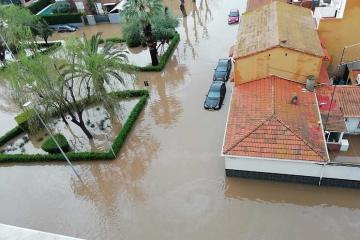
Flooding affects Navarre Region, Spain, December 2021
News
2022-02-03
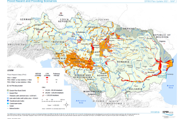
Danube Flood Risk Management Plan 2021 and EFAS
News
2022-01-18
New EFAS partner in Denmark
News
2022-01-12
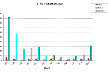
Summary of EFAS Notifications in 2021
News
2022-01-06
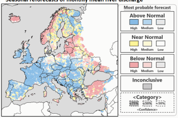
European multimodel seasonal forecasts now available on CDS
News
2021-12-17
5th H SAF User Workshop upcoming
News
2021-12-16
High reliability of EFAS notifications for Spain during 2020
News
2021-12-13
Floods in northern Italy , early October 2021
Pagination
Previous page
‹‹
Page 18
Next page
››
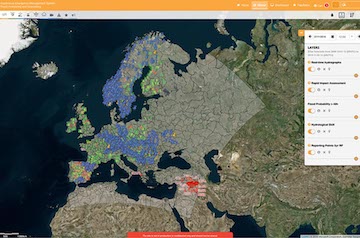
Map viewer
Training