Skip to main content
Search
Navigazione principale
About
Products
Data access
Collaborate
News and events
Resources
Training
Notifications
EFAS Wiki
News
News
2024-08-09
Floods in Poland and Slovakia, July 2024
News
2024-08-01
Release of new EFAS version 5.2
News
2024-07-18
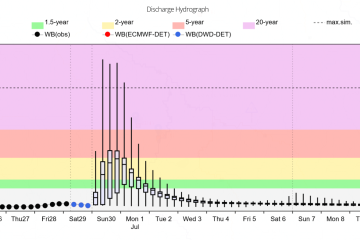
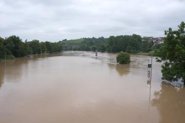
Floods in Southern Germany, June 2024
News
2024-07-10
EFAS Partner Survey 2023
News
2024-07-10
EFAS Partner Survey 2024
Event
2024-07-04
Webinar: New notification criteria and area of validity on 4 July 2024
Event
2024-07-04
EFAS v5.2 pre-operational release is available in test phase from https://stage.efas.eu/en
News
2024-06-20
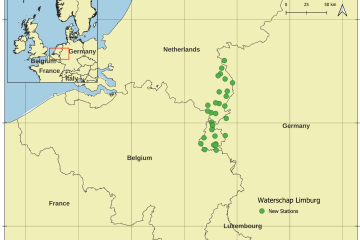
CEMS HDCC integrated hydrological station data from Waterschap Limburg (Netherlands)
News
2024-06-20
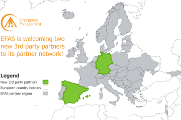
New EFAS Partners in Germany and Spain.
News
2024-06-11
Floods and storms in Western Europe, May 2024
Pagination
Previous page
‹‹
Page 7
Next page
››
Map viewer
Training