by Mirza Sarač, ISRBC Secretariat
The international Sava River Basin Commission established a joint Hydrological Information System platform for the Sava River Basin in 2015 (Sava HIS – www.savahis.org) in cooperation with relevant national institutions from the Sava River Basin. The cooperation was set up under the Framework Agreement for the Sava River Basin for the exchange and use of the hydrological and meteorological information and data. Sava HIS was established taking into account Policy on the Exchange of Hydrological and Meteorological Data and Information in the Sava River Basin, prepared by the Sava Commission in close cooperation with WMO. The Policy was signed by national hydrometeorological services and two water agencies in 2014.
Sava HIS represents a tool for collecting, storing, analysing and reporting a sufficiently high quality hydrological and meteorological data as a component of Geographical Information System for the Sava River Basin (Sava GIS – www.savagis.org).
The overall objective of Sava HIS is to support the countries in the Sava River basin in sharing and disseminating hydrologic and meteorological data, information and knowledge about the water resources. Those data and information are used for decision-making system in all aspects of water resources management, in the wide range of operational applications as well as in research. Since the Water ML 2.0 format (the WMO exchange standard via web services) was implemented in Sava HIS, the system has enabled storage of water observations data and spatial information in a standard format as well as supporting data sharing and publication via web services for further use.

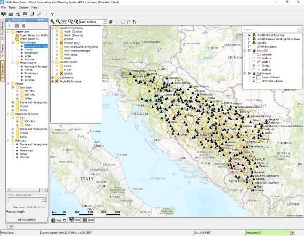
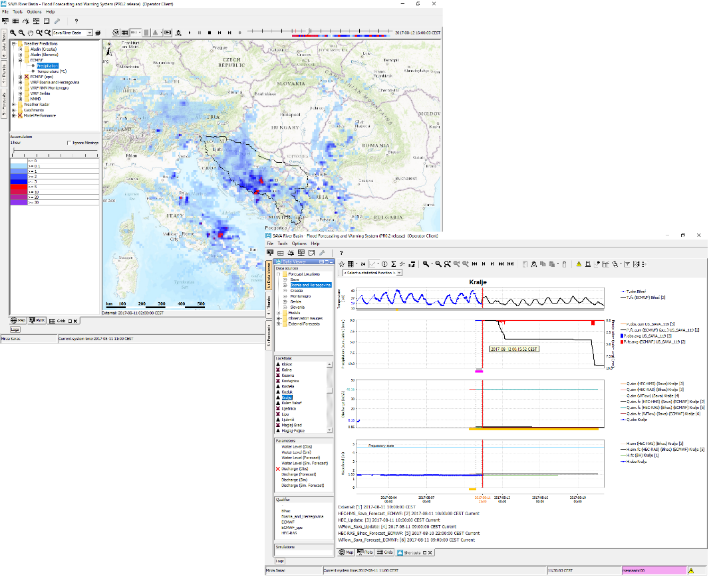
Currently, the Sava countries are in the process of establishing a Flood Forecasting and Warning System in the Sava River Basin (Sava FFWS) which will be finalized by the end of August 2018. Based on the Delft-FEWS platform, Sava FFWS will be implemented as an open shell platform for managing the data handling and forecasting process, allowing a wide range of external data and models to be integrated. This concept is particularly important for the five cooperating Sava countries, where different forecasting systems and models are in use.
Sava FFWS will integrate Sava HIS as a data hub for the collection of real-time hydrological and meteorological data. These include Sava GIS for presentation of spatial layers, as well as various numerical weather prediction models (ECMWF, Aladin, WRF, NMMB), available weather radar and satellite imagery (OPERA/ERICHA and H-SAF products), outputs of the existing national forecasting systems, different meteorological, hydrological and hydraulic models. All data will be easily ‘plugged’ into a common platform. The resulting system will enable the five countries involved to take the right management decisions and implement operational measures to prevent and mitigate severe flood and drought situations based on reliable forecasts of water levels and discharges with a long lead-time within area of an entire river basin.
With these systems developed through the cooperation of countries within the scope of work of the Sava Commission, the Sava countries should be better prepared for emergency situations like the one that occurred in May 2014, when disastrous floods in the Sava basin resulted in 79 casualties and substantial economic damage. Sava HIS and Sava FFWS are a very special regional concepts taking into account that the Sava River Basin (97,700 km2) is shared by five countries: Slovenia, Croatia, Bosnia and Herzegovina, Montenegro and Serbia where each country has its own models, monitoring systems, forecasting systems, water authorities and interests. This regional, basin-wide concept will bridge differences and support collaboration in the field of water management, keeping the countries’ own autonomy in monitoring, modelling and forecasting, and remain open to developing its own models and supplementary forecasting initiatives.
The system brings added value to existing or developing systems, expecting that a common forecasting platform with well-trained staff should provide better preparedness and optimized mitigation measures to significantly help reduce consequences of floods.

